| Any recommendations for alternatives to google maps 11:14 - Oct 13 with 1943 views | Ryorry |
For tracking my routes on rural walks please?
Not just for pathfinding, but for showing where I’ve just been. Stems from a public footpath on a moor petering out, me getting lost, and then when I got to a minor road, having difficulty locating my parked car!
Google maps was good and accurate 5 years ago so I tried that, but it’s now deteriorated so badly it shows the rural roads I’ve actually walked in the past 2 weeks as going across fields a mile away - or doesn’t track my walking up and down them at all.
Would like one whuch gives a 3-D option. Searching has thrown up a lot of suggestions, but does anyone have one that’s tried and tested please? Cheers if you can help.
|  |
| |  |
| Any recommendations for alternatives to google maps on 22:13 - Oct 13 with 396 views | ronnyd |
| Any recommendations for alternatives to google maps on 12:52 - Oct 13 by Plums |
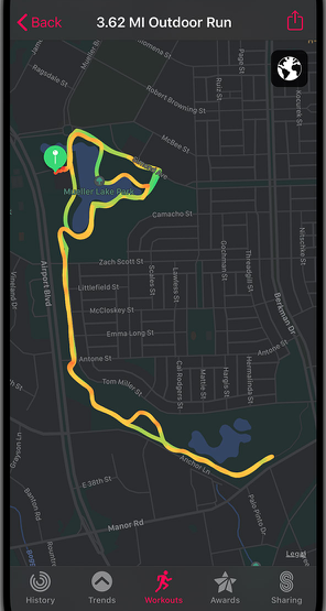
For new routes, I like the jeopardy of using the free version of:
https://footpathmap.co.uk/
combined with Strava.
I haven't looked at the paid for solution but it appears to have some good features. [Post edited 13 Oct 12:54]
|
I use FPM too. The free option is ok for my needs now as my serious hiking days are sadly over. |  | | |
| Any recommendations for alternatives to google maps on 22:31 - Oct 13 with 365 views | WeWereZombies |
| Any recommendations for alternatives to google maps on 20:27 - Oct 13 by Ryorry |
Please can you link me to anywhere that sells weightless physical maps?!
Thought bubble - maybe you have them printed on silk Y-fronts or something … 🤔 |
With the physical ones it's not so much the weight as the size, needs a special pair of trousers to accommodate them... |  |
| |
| Any recommendations for alternatives to google maps on 00:20 - Oct 14 with 332 views | Ryorry |
| Any recommendations for alternatives to google maps on 22:31 - Oct 13 by WeWereZombies |
With the physical ones it's not so much the weight as the size, needs a special pair of trousers to accommodate them... |
And a spare pair special of trousers for when they get wet?*
*Everyone knows it rains a lot in Ireland. | |
| |
| Any recommendations for alternatives to google maps on 02:03 - Oct 14 with 291 views | KingsCrossBlue |
Maps.me
Works offline too once downloaded. I’ve used them extensively in the weirdest, remotest places and got me out of trouble numerous times | | | |
| Any recommendations for alternatives to google maps on 07:46 - Oct 14 with 248 views | GlasgowBlue |
| Any recommendations for alternatives to google maps on 00:23 - Oct 14 by Ryorry |
Had one for years, use the health app daily for steps, but never knew the fitness option did that - cheers 👍 |
Oops. It appears you can no longer track routes on an iPhone without an Apple Watch. Sorry. You used to be able to do so but I’ve had Apple Watches for t3n years so didn’t realise that function no longer worked on its own.
There is a workaround though with no cost,
Download the Nike run app. Use the Nike run app when walking and it syncs with Apple fitness displaying your route in a map, how many miles etc. |  |
| |
| Any recommendations for alternatives to google maps on 07:52 - Oct 14 with 244 views | bluelagos |
| Any recommendations for alternatives to google maps on 02:03 - Oct 14 by KingsCrossBlue |
Maps.me
Works offline too once downloaded. I’ve used them extensively in the weirdest, remotest places and got me out of trouble numerous times |
Yep, used them overseas. You get 10 free maps before you have to pay.
Focused on roads so little use on hills/mountains.
And it's 10 downloads per phone so if you have more than 1.phone can get additional maps.
Downloaded it after walking round for 90 mins trying to find a hotel after too many beers...works a treat :-) |  |
| |
| Any recommendations for alternatives to google maps (n/t) on 10:28 - Oct 14 with 216 views | AlexMathie |
| |
| |
Login to get fewer ads
| Any recommendations for alternatives to google maps on 10:30 - Oct 14 with 213 views | AlexMathie |
I would definitely recommend OS maps if you can afford it. Has all definitive footpaths/bridleways etc.
The problem with Strava, Komoot, AllTrails etc. is their mapping is underpinned by OpenStreetMaps which relies on users adding footpaths. I’ve found out in rural Suffolk that a lot of these paths haven’t been mapped, leading me to revert to OS maps. [Post edited 14 Oct 17:21]
| |
| |
| Any recommendations for alternatives to google maps on 13:37 - Oct 14 with 173 views | Ryorry |
| Any recommendations for alternatives to google maps on 14:16 - Oct 13 by NthQldITFC |
Openstreetmap via OSMAnd+ is what I use on my Android phone for cycling and walking. Way better than G**gle for anything that doesn't revolve around main roads and advertising shops/restaurants/other sh*t.
https://www.openstreetmap.org/#map=6/54.91/-3.43
https://osmand.net/
With the app, you can use a 3d 'tilted' view, which is great on a bike as you have more detail close to you, but wider FOV at distance. You can add contours and hillshading and choose from a variety of styles of presentation for what suits you best. The + version of OSMAnd is a small one-off charge, but there's a free version too, I can't remember why I upgraded, but as I say it's a small charge and not a monthly one.
Main reason I originally chose it is that it works offline, and you can download whatever area of detailed mapping you want, plus things like wikipedia info for stuff in the area.
https://footpathmap.co.uk/ which is mentioned above uses OSM as its default base layer (tonnes of online mapping sites do) and superimposes footpath/bridleway/right of way data which can also be downloaded (and manually updated) from https://footpathmap.co.uk/ and added to OSMAnd if you want an offline version with up to date rights of way as specified by the local authority. [Post edited 13 Oct 14:29]
|
Hi NthQld
Re the OSMAnd, have paid for a month (£2.99) & downloaded the required plugins, read the help sections etc. but still can’t get anything like the terrain/satellite/shading/tilted options you mentioned. They just don’t appear in the ‘configure map’ menu. Any advice please? Ta if you can help! | |
| |
| Any recommendations for alternatives to google maps on 13:54 - Oct 14 with 166 views | NthQldITFC |
| Any recommendations for alternatives to google maps on 13:37 - Oct 14 by Ryorry |
Hi NthQld
Re the OSMAnd, have paid for a month (£2.99) & downloaded the required plugins, read the help sections etc. but still can’t get anything like the terrain/satellite/shading/tilted options you mentioned. They just don’t appear in the ‘configure map’ menu. Any advice please? Ta if you can help! |
I'm assuming you have the '+' version (OsmAnd+ rather than plain OsmAnd) if you've paid for it? (Blimey, it's gone up in price, I guess I got in early)
Anyway, for me on OsmAnd+, contour lines & hillshading are in the Topography section on the Configure Map menu. But you have to download the detailed maps, terrain maps (contours, hillshading, slopes, 3d) files for the areas you're interested in, depending upon how much storage space you have available (works fine off an SD card for my fairly old phone) (see https://osmand.net/docs/user/personal/maps-resources ).
When you've done that you should see a '3D' icon when you're using the map which enables it to tilt into a sort of 3d view mode.
It's very configurable and consequently there are a lot of settings to try out, but that docs site (link above) is really quite good although you need a bit of time to go through and configure things exactly how you want them. [Post edited 14 Oct 13:55]
|  |
| |
| Any recommendations for alternatives to google maps on 14:16 - Oct 14 with 154 views | Ryorry |
| Any recommendations for alternatives to google maps on 13:54 - Oct 14 by NthQldITFC |
I'm assuming you have the '+' version (OsmAnd+ rather than plain OsmAnd) if you've paid for it? (Blimey, it's gone up in price, I guess I got in early)
Anyway, for me on OsmAnd+, contour lines & hillshading are in the Topography section on the Configure Map menu. But you have to download the detailed maps, terrain maps (contours, hillshading, slopes, 3d) files for the areas you're interested in, depending upon how much storage space you have available (works fine off an SD card for my fairly old phone) (see https://osmand.net/docs/user/personal/maps-resources ).
When you've done that you should see a '3D' icon when you're using the map which enables it to tilt into a sort of 3d view mode.
It's very configurable and consequently there are a lot of settings to try out, but that docs site (link above) is really quite good although you need a bit of time to go through and configure things exactly how you want them. [Post edited 14 Oct 13:55]
|
Thanks - it’s called ’OSMPro’ - maybe other things have changed too since you signed up? I do have the 3D button but it doesn’t offer me any layerings/tiles. Got the docs. site up to read in dentist’s waiting room! and I’ll try re-loading the maps 👍 | |
| |
| Any recommendations for alternatives to google maps on 16:00 - Oct 14 with 117 views | Sacrebleu |
Strongly recommend TOPO GPS. I think you’ll find everything you need there for country walks. |  | | |
| Any recommendations for alternatives to google maps on 17:32 - Oct 14 with 87 views | parhamblue |
mapy.com mapy.cz It gives a 3D option. Can download and use offline. Has voice nav if required. Very limited guide to wikipedia pages usually - again not needed by many people. I have used it alongside other walkers who all have their own favourite apps. The thing about all these apps that are free (and some paid as well) is they all use openstreetmap contributors and where there has been a change to the path they usually all take the same amount of time (sometimes years) to catch up. | | | |
| Any recommendations for alternatives to google maps on 17:47 - Oct 14 with 79 views | mellowblue |
| Any recommendations for alternatives to google maps on 13:40 - Oct 13 by Ryorry |
Thanks everyone. Three positive mentions for Strava, so will look at that first, as well as the others.
Saw Komoot & AllTrails (+ OS that I knew about but has maybe improved since I last looked some time ago) in a top 10.
Also British Red Cross First Aid app + MyRadar weather app came up as recommended on one search. |
Komoot is pretty good for suggested off the beaten track type walks as people walk and load them. Use it when I am in an unfamiliar area. | | | |
| |